Provea Satellite is a web service providing phytosanitary, water stress and nitrogen monitoring services using satellite images in time series. It is implemented in integration with Provea Precision Agriculture Decision Support System.
Indexes Created with Satellite Bands
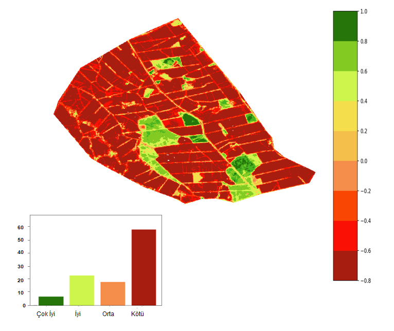
Vegetation / Health Map
It is used to monitor agricultural production, to monitor production quality and plant vitality / health, to predict production amount, to monitor drought and to map.
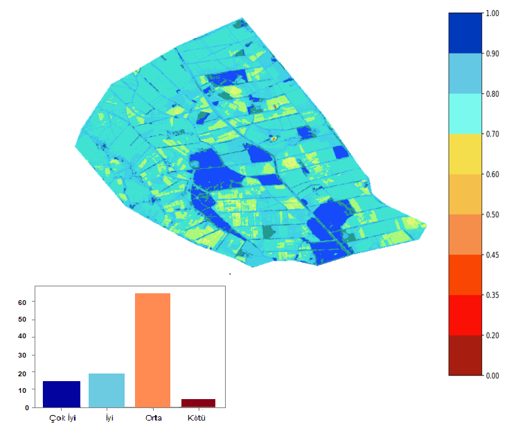
Water Stress Map
They are maps created by using reflected near infrared radiation and visible green light to enhance the presence of such features while eliminating the presence of soil and terrestrial vegetation features. Turbidity estimates of water bodies can also be made using remotely sensed digital data.
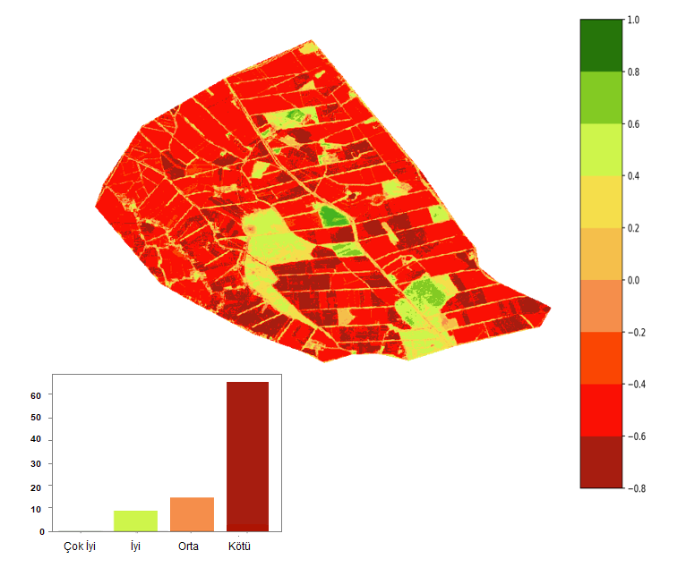
Nutrition Map
This map was created by estimating the relative amounts of nitrogen found in vegetation. The total canopy nitrogen content is calculated by the leaf nitrogen concentration and the canopy leaf biomass.